Information Technology
Courthouse
201 State St.
Boone, IA 50036
Driving Directions
Contact Information
515-433-4922
Our Team
Information Technology
T he Boone County Information Technology Department was formed with the objective of helping all county departments using technology to carry out their core tasks. The IT department is responsible for the purchase, maintenance, and security of technology equipment and software; and supports county departments in technology projects. The IT department is staffed by an IT Director and GIS Coordinator.
What is GIS?
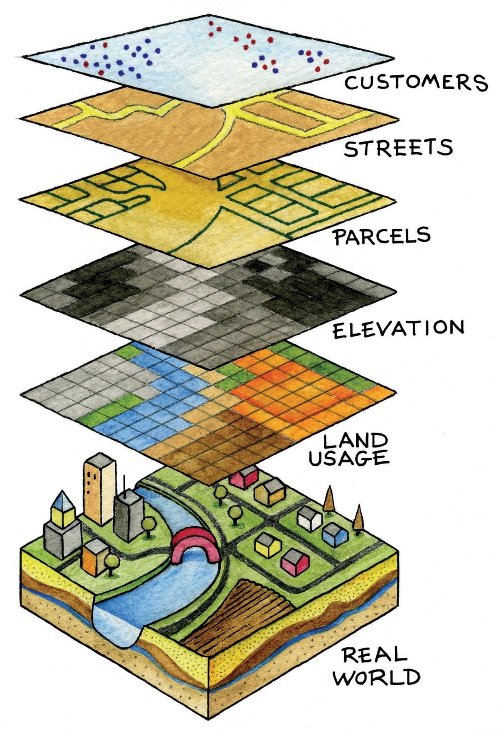
A spatial system that creates, manages, analyzes, and maps all types of data.
A geographic information system (GIS) is a system that creates, manages, analyzes, and maps all types of data. GIS connects data to a map, integrating location data (where things are) with all types of descriptive information (what things are like there). This provides a foundation for mapping and analysis that is used in science and almost every industry. GIS helps users understand patterns, relationships, and geographic context. The benefits include improved communication and efficiency as well as better management and decision making.


